How it works

Sidewalk to system of record, in five steps

No three-vendor handoffs. Capture, process, assess, review, and sync all live in one platform — built so a public works team can run it without a GIS contractor.

01

Capture the network

Bring your own LiDAR — handheld, mobile mapping, or drone .las/.laz uploaded via API or bulk tool — or deploy an Argis SCOUT survey unit to capture survey-grade data directly on the sidewalk, where vehicle scanners can't reach.
02

Run the processing pipeline

Eight automated stages: load the scan, parse the point cloud, extract trajectory, segment sidewalk from road and vegetation, detect surface defects, measure slopes, run the PROWAG compliance check, and draft the engineering summary.
03

Score against PROWAG

Every measurement is evaluated against PROWAG 2023 thresholds — vertical discontinuity at 6.4mm, cross slope at 2.1%, running slope at 5.0% — each with its own pass, borderline, or noncompliant verdict and confidence band.
04

Review in 3D

Open any defect in the interactive viewer. Switch between RGB, depth, and ADA-risk modes to verify geometry and severity remotely, before anyone schedules a site visit.
05

Seal, report, and sync

Argis drafts findings and repair recommendations, routes the report for licensed PE review and seal, then syncs results live into your ArcGIS feature layer and a priority-scored work queue.
The pipeline

Eight stages, fully automated

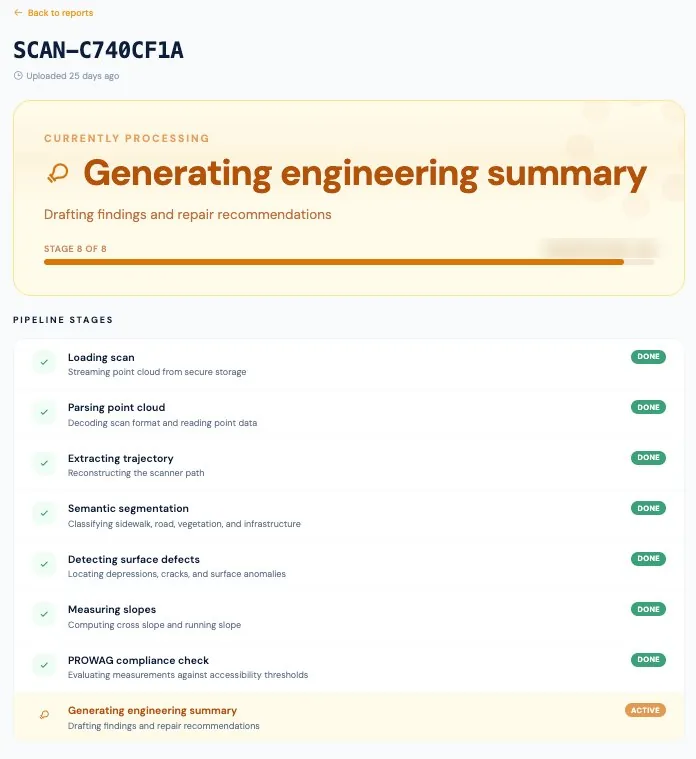
From point-cloud parsing to the drafted engineering summary — every stage tracked and visible.

Argis Labs 8-stage processing pipeline from loading the scan to generating the engineering summary
Living data

Built for rescans, not one-time snapshots

A transition plan goes stale the day it's printed. Argis is designed for an ongoing cadence — rescan, re-score, and watch your compliance posture improve over time.

01

Defensible by default

Current, sealed documentation is the difference between defending a Title II claim and settling it.

02

Prioritized spend

Fix the highest-risk barriers first, with a composite priority score behind every work order.

03

No data silos

Your city owns all scan data and can export everything to GeoJSON or JSON at any time.

Request a demo

Secure your city's accessibility record

Every month without current data leaves your department exposed to Title II liability you can't defend. Bring a sample of your LiDAR, or let us scope a SCOUT survey — we'll show you a live assessment on real data.

Book a demo See how it works