The platform

From raw LiDAR to a defensible record

One connected system: ingest scans, score them against PROWAG, inspect defects in 3D, generate sealed reports, and keep your GIS in sync — without stitching three vendors together.

01

Scan ingestion

Accepts .las/.laz from any source. Automated trajectory extraction, semantic segmentation, and defect detection on ingest — handheld, mobile mapping, drone, or SCOUT survey unit.
02

PROWAG assessment

Scores vertical discontinuity (R302.6.2), cross slope (R302.5), and running slope (R302.4) against PROWAG 2023, with measurement counts and confidence per criterion.
03

3D defect viewer

WebGL point cloud per defect with RGB, depth, and ADA-risk modes. Review geometry remotely without a truck roll.
04

Sealed reports

A clear compliance verdict with drafted findings and repair recommendations, routed for PE review and seal. PDF and JSON export.
05

Live ArcGIS sync

OAuth-connected hosted feature layer. Defect location, status, measurements, and severity flow into Esri and stay in sync.
06

Prioritization

Composite priority score per defect drives a triage queue across scheduled, in-progress, complete, and rescan states.
The assessment

Compliance, by criterion

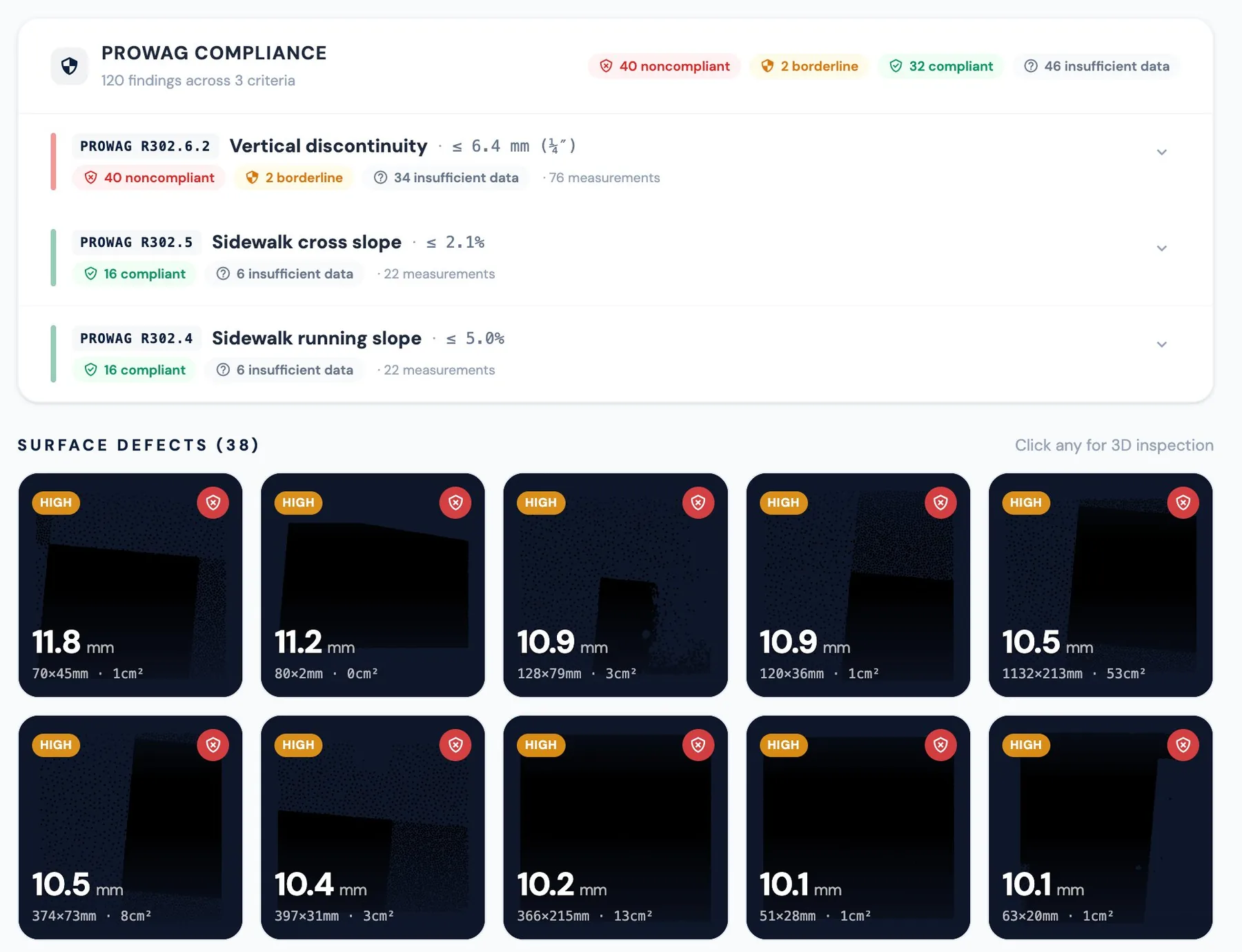
PROWAG verdicts across every criterion, with each detected defect ranked by severity.

PROWAG compliance assessment with defects across three criteria and a surface-defect grid
3D inspection

Every defect, in survey-grade 3D

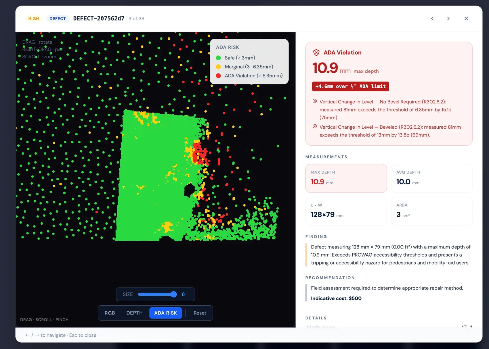
Switch between true color and an ADA-risk overlay that colors every point against the PROWAG depth threshold — with max depth, area, and indicative cost on the panel.

True-color 3D point cloud of a sidewalk defect with measurements panel
RGB mode — photoreal capture with the full measurement and finding panel.
ADA-risk overlay coloring point cloud safe, marginal, and violation
ADA-risk mode — safe, marginal, and violation points against the threshold.
Sealed reporting

A verdict, not just a dashboard

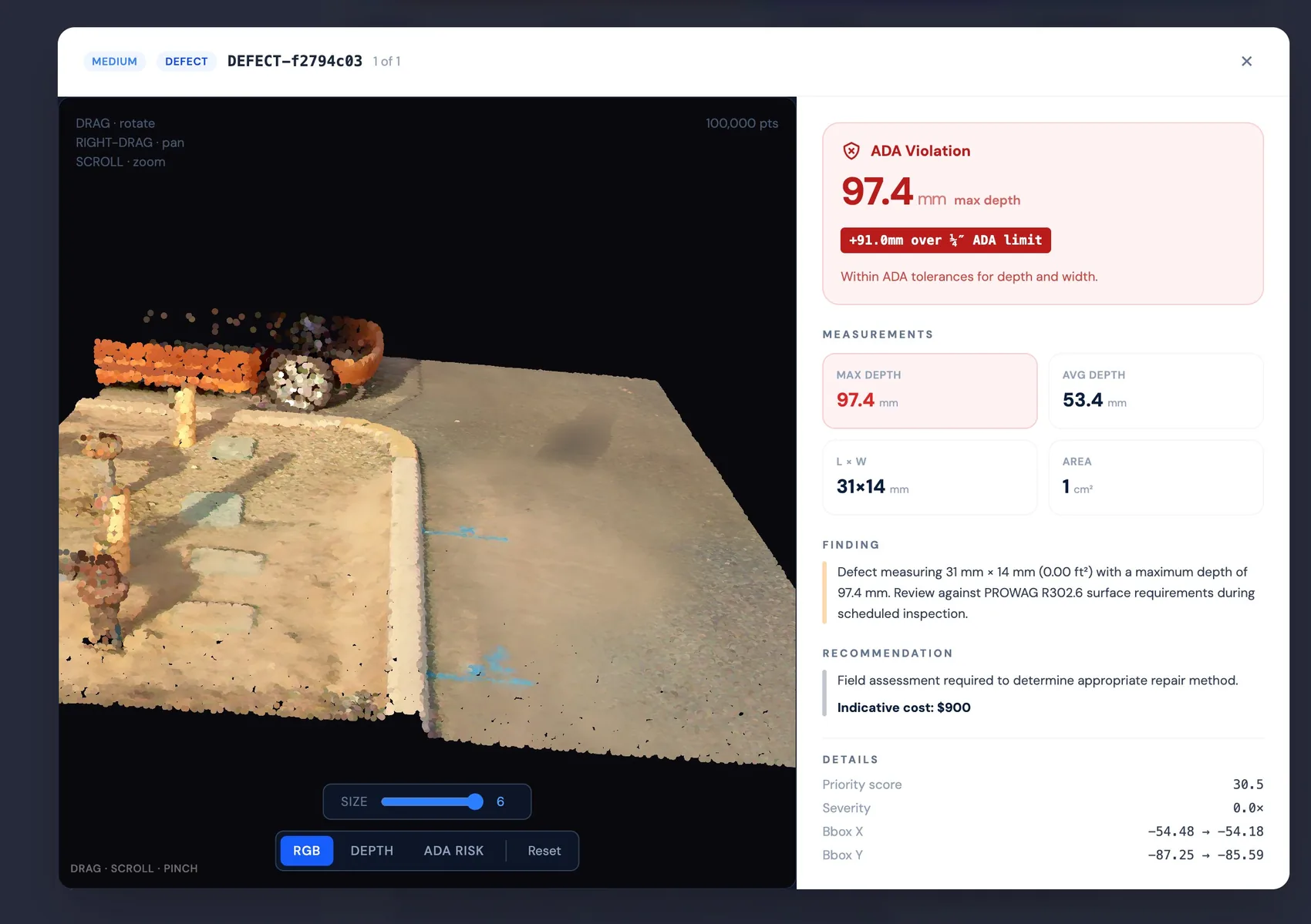
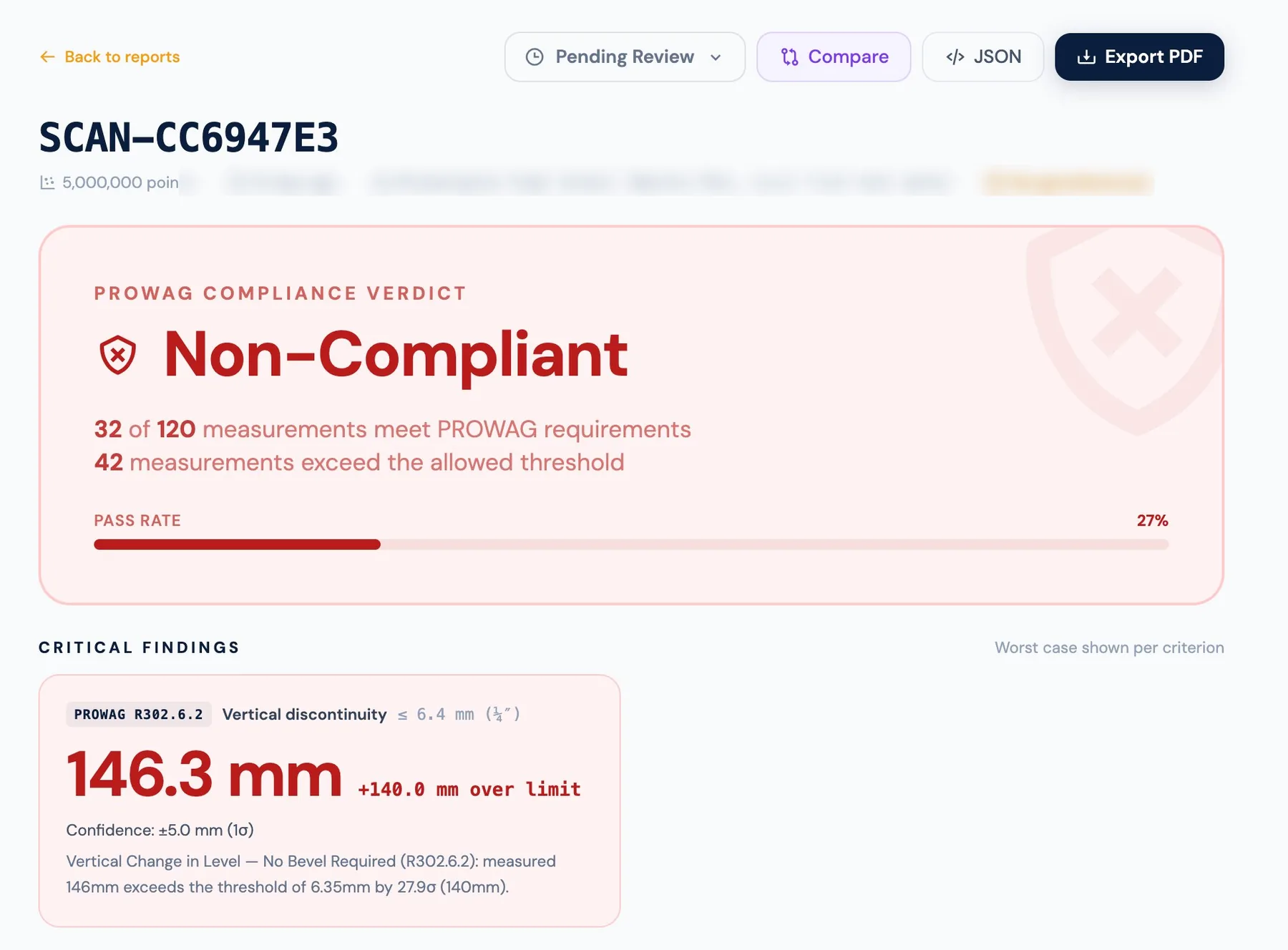
Each report opens with a plain compliance verdict and pass rate, then the worst-case finding per criterion — drafted from the scan data and routed for licensed PE review and seal.

  • Compliant / Non-Compliant verdict with measurement count
  • Critical findings cited to specific PROWAG criteria
  • Pending-review workflow before a report is sealed
  • Export to PDF for work orders or JSON for your systems
Compliance report showing Non-Compliant verdict, pass rate, and critical findings
ArcGIS-native

Live data for your GIS team, not a one-time export

Most tools push a file into ArcGIS after a project ends. Argis keeps a hosted feature layer in continuous sync — the moment a scan is assessed, the layer updates. No clicks, no stale snapshots.

Request a demo

Secure your city's accessibility record

Every month without current data leaves your department exposed to Title II liability you can't defend. Bring a sample of your LiDAR, or let us scope a SCOUT survey — we'll show you a live assessment on real data.

Book a demo See how it works